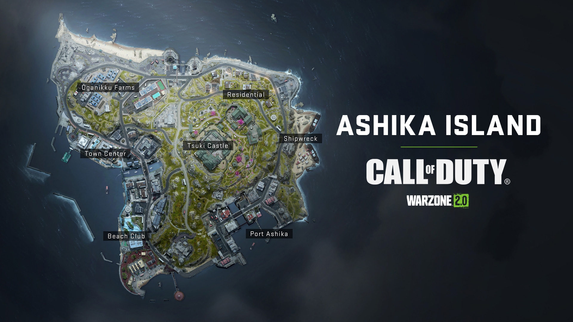
ASHIKA ISLAND MAP OVERVIEW IN CALL OF DUTY: WARZONE 2.0

Ashika Island is set on an island also called Sea Lion Island. It is located in a small archipelago somewhere in the Asia-Pacific region (coordinates are classified). According to the latest intelligence, this island has become the base of the ultranationalist Konni Group, which uses it, among other things, to transport chemical and biological weapons. The report received says that most likely chemical weapons are being sent here from the biolab in Al-Mazra.
Initially, the island was supposed to be a resort, but its development stopped in the mid-1990s. Since then, getting on the island or leaving it has become extremely difficult.
Reports have recently been intercepted that a part of the Shadow group has seized control of the island and is apparently looking for members of the Connie group. The island seems to be abandoned, but there are rumors that the performers of the Connie group continue to work in the conflict zone.
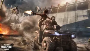
Wherever you land, exercise extreme caution.
Point of Interest: Ōganikku Farms
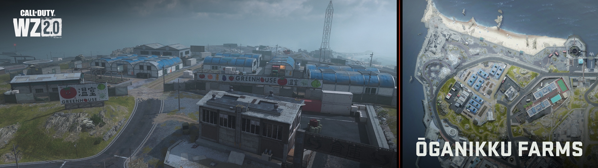
The main part of the northwestern sector of the Ashika Island map is occupied by agricultural, residential and industrial buildings, as well as old defensive coastal structures.
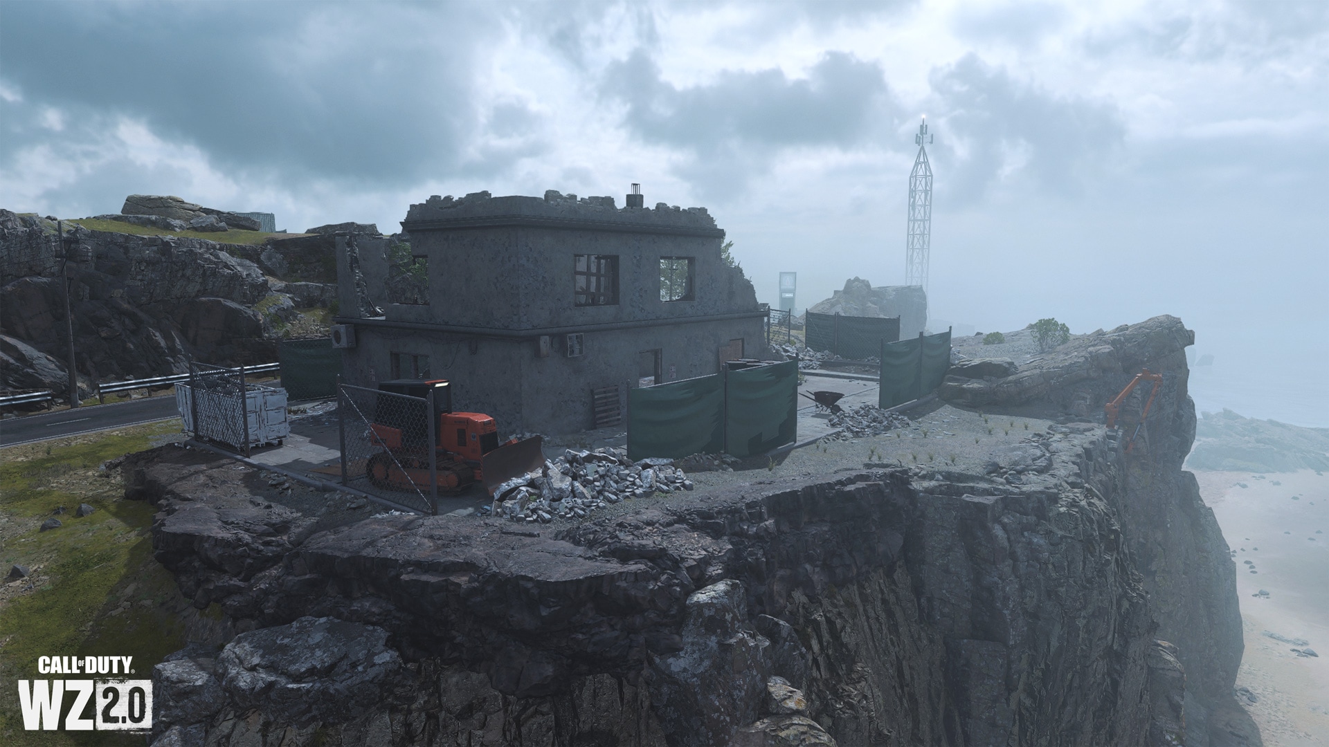
Observation post and ruins
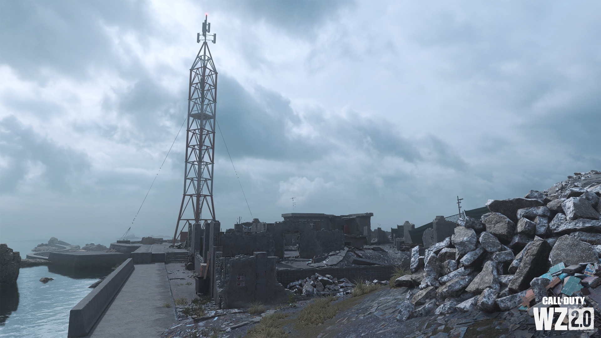
In the very north-west of the island there is a communication tower (this and two other towers can serve as landmarks anywhere on the map) – it is located on a sandy-stony spit with a breakwater. Moving from the tower deep into the island, you will see a pile of concrete and two not completely demolished buildings from the time of the war.
north beach
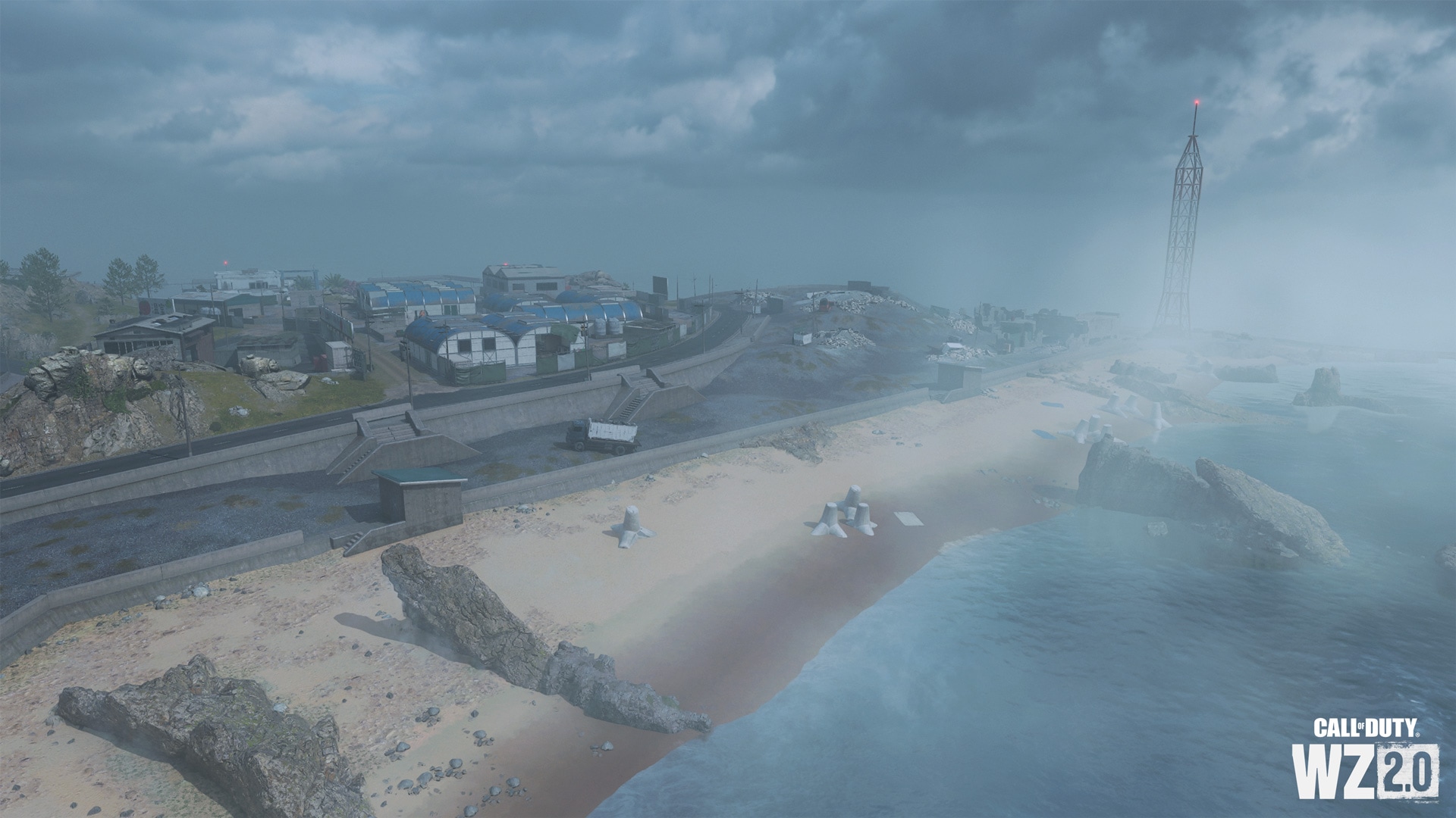
A gently sloping beach awaits you with miniature breakwaters partially sunk into the sand and scattered cobblestones. Also from here you can get to the main part of the island or the water treatment plant in the east.
Greenhouses
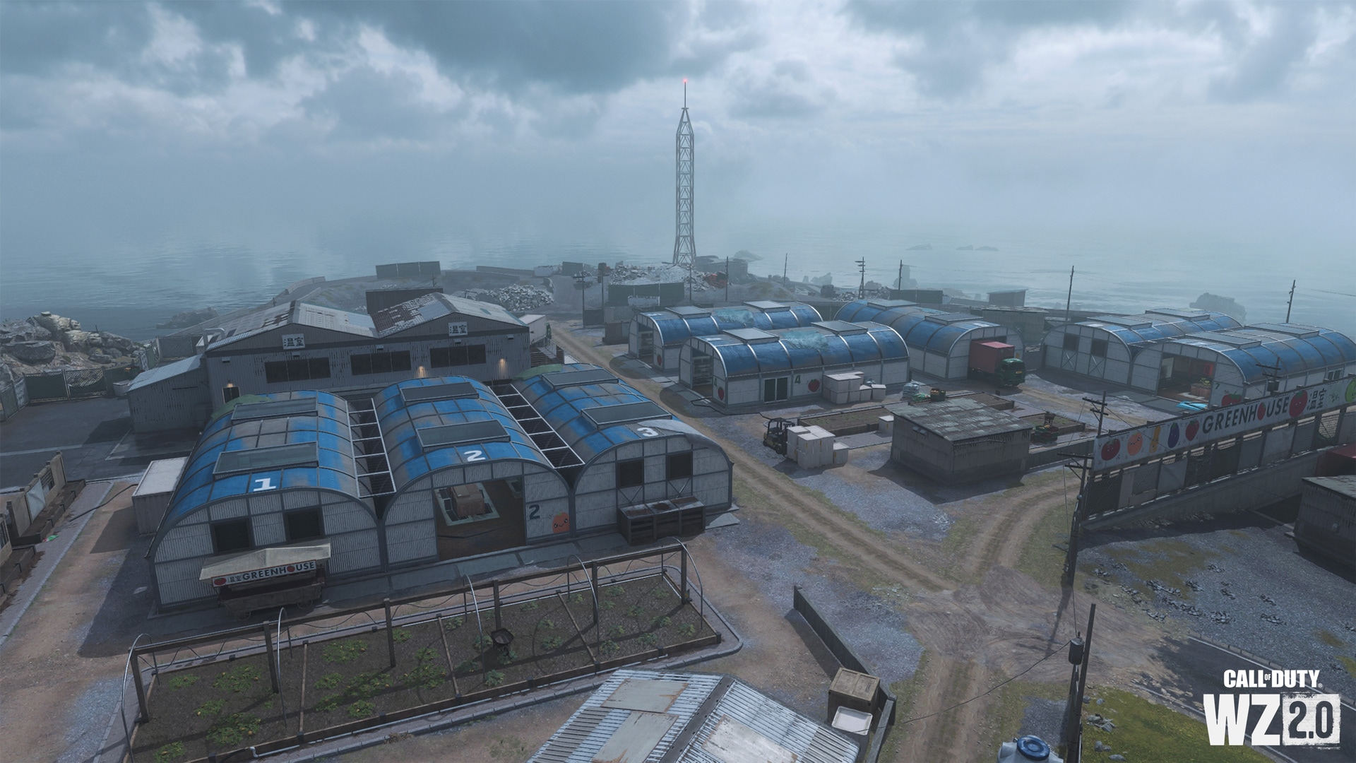
A row of agricultural buildings with a yard, warehouses and eight separate greenhouses, which can be easily recognized by the numbers on the roofs. Various fruits and vegetables grow inside, indicated by drawings on the walls. To the southeast is the main entrance and additional service warehouses.
Attraction: city center
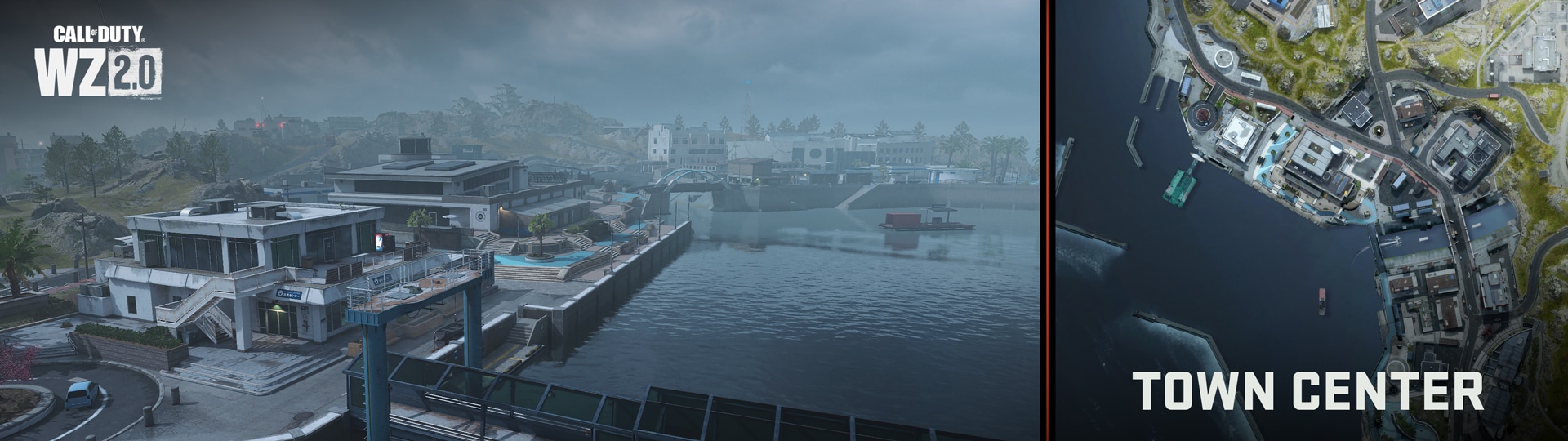
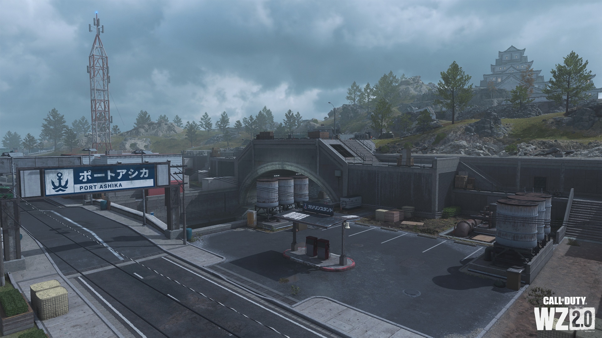
The western and part of the southwestern part of the island is washed by the waters of the bay, in which powerful breakwaters are located. To the northwest of the main underwater channel is a ferry terminal and tourist facilities. Crossing the bridge over the canal, you will see the hotel and the market area, as well as the gas station and the city hall in the shape of a semicircle.
northern breakwater
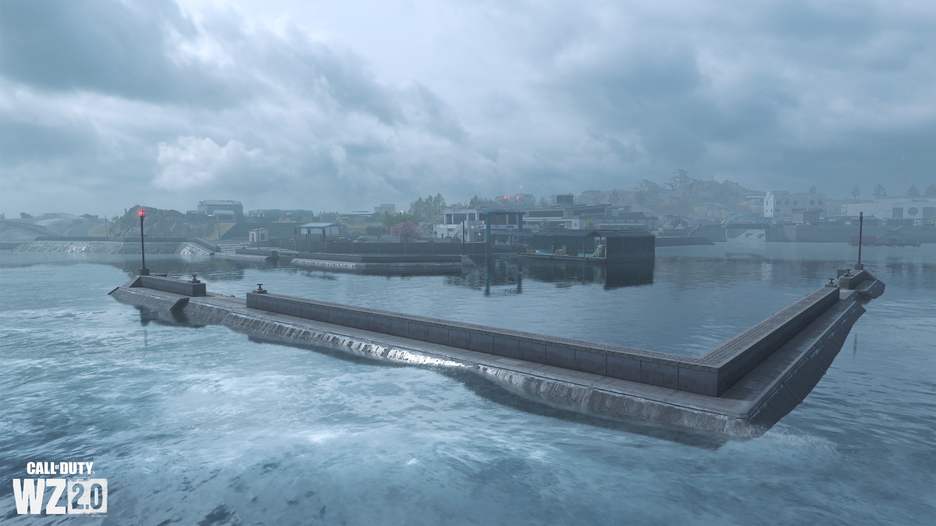
Further from the shore are two barriers in the shape of the letter L, standing firmly on the bottom and preventing the tides from flooding the island. You can get there, but there is no hiding place, except under water. A small descent for boats completes the picture.
ferry terminal
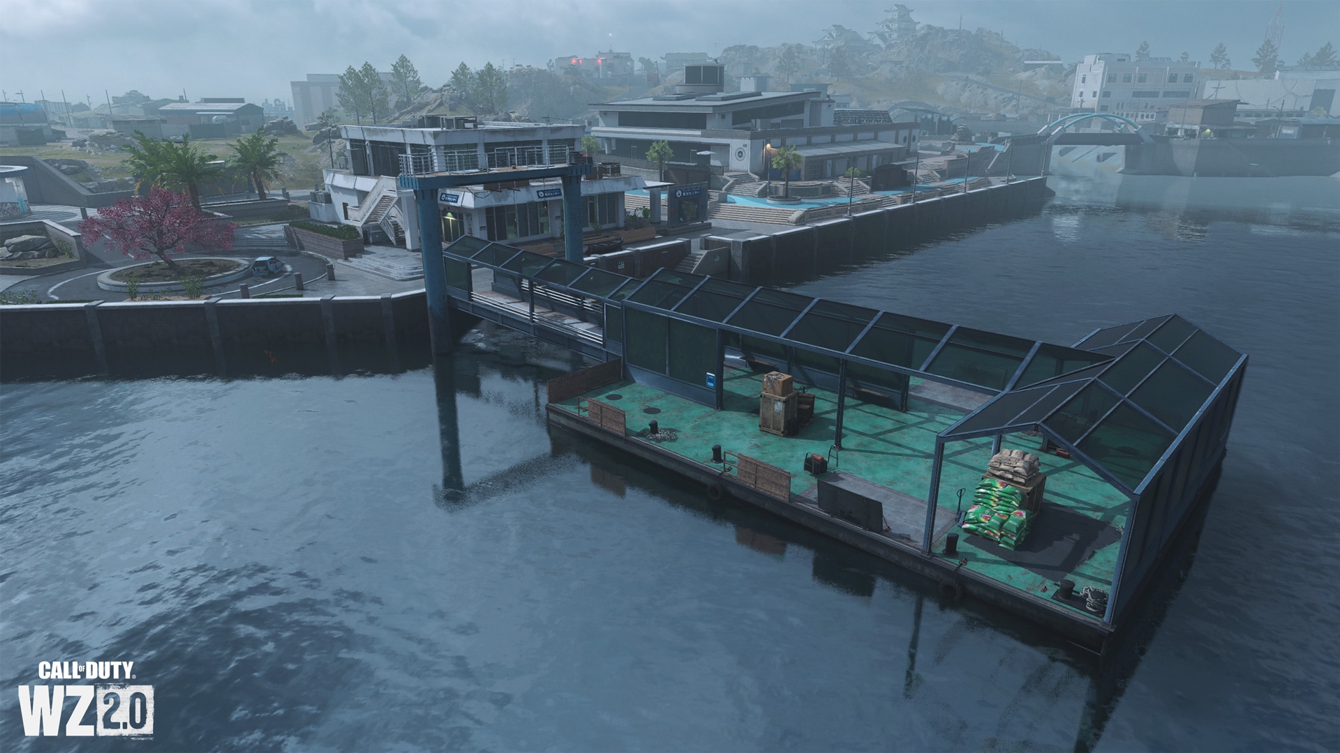
At the steel pier, visitors can disembark from the ferries that regularly arrived on the island prior to the current hostilities. From the pier you can quickly get to the tourist center. In addition, from here you can get to the round parking and to the restrooms (also round).
Tourist centre
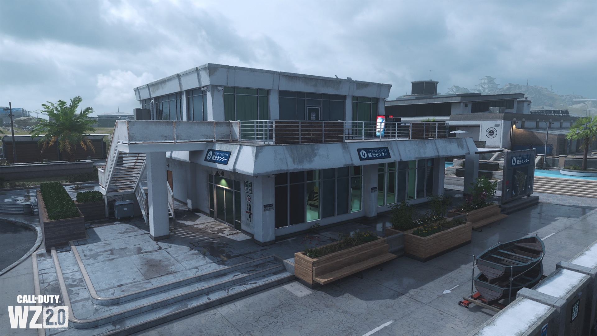
In this white concrete building covered with rain stains, visitors can learn more about the island and can view a map of the area, as well as stop by a small gift shop or kitchens. The performers will have an interesting view towards the farms and the city center.
Exhibition Center
Parallel to the blue concrete embankment that leads east and southeast to a similarly colored aquarium is a medium-sized exhibition center recognizable by its signage and solar panels on the roof. Inside there is a reception hall and a main banquet hall with a glass roof.
Gas station
At a small gas station, the already familiar services for repairing and refueling vehicles are available. Through it, you can also go on the road to any part of the island.
Science Center
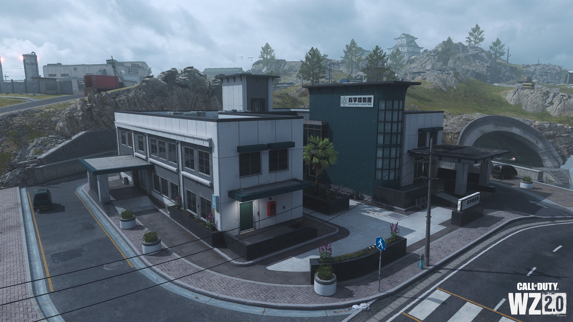
Not far from the canals is a modern science center, inside and on the roof of which you can get in several ways. On the east side it is supported by a rock. The interior of this U-shaped building consists of two floors (an internal balcony on the second floor overlooks the main entrance hall), a staircase to the roof, and an elevator that can be easily descended with a rope.
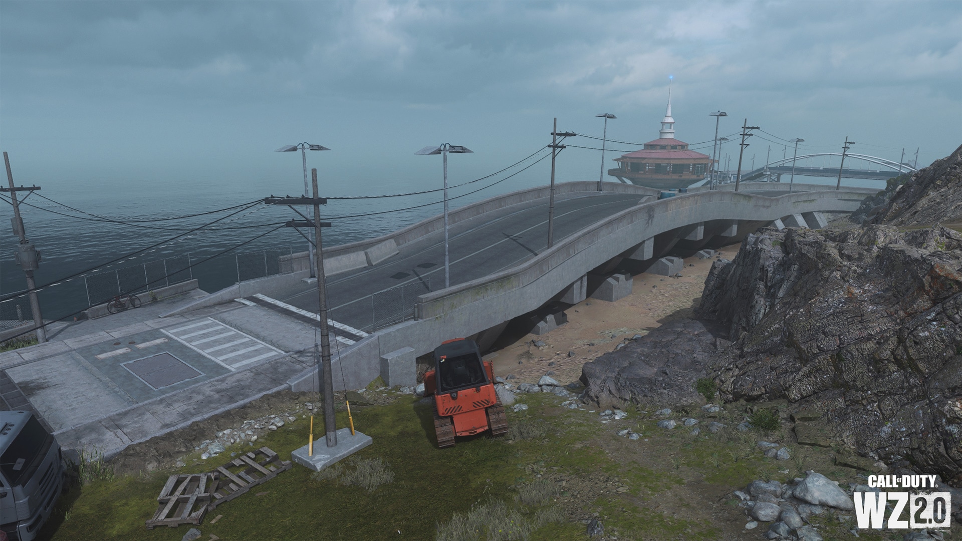
River channel and bridges
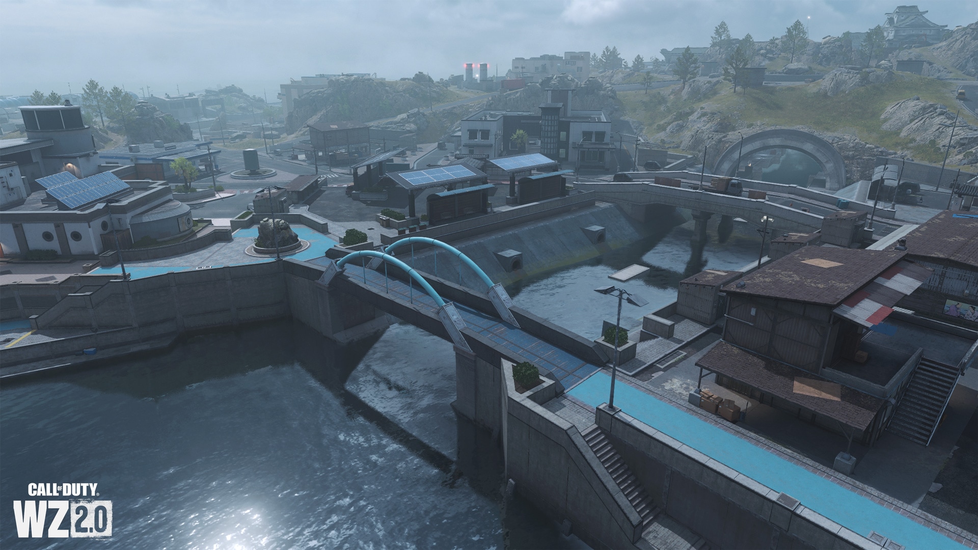
This canal, crossed by two bridges, is the western entrance to the waterways that run under the island. You can also easily get to the sloping concrete embankments. Notice the blue metal arch on the bridge.
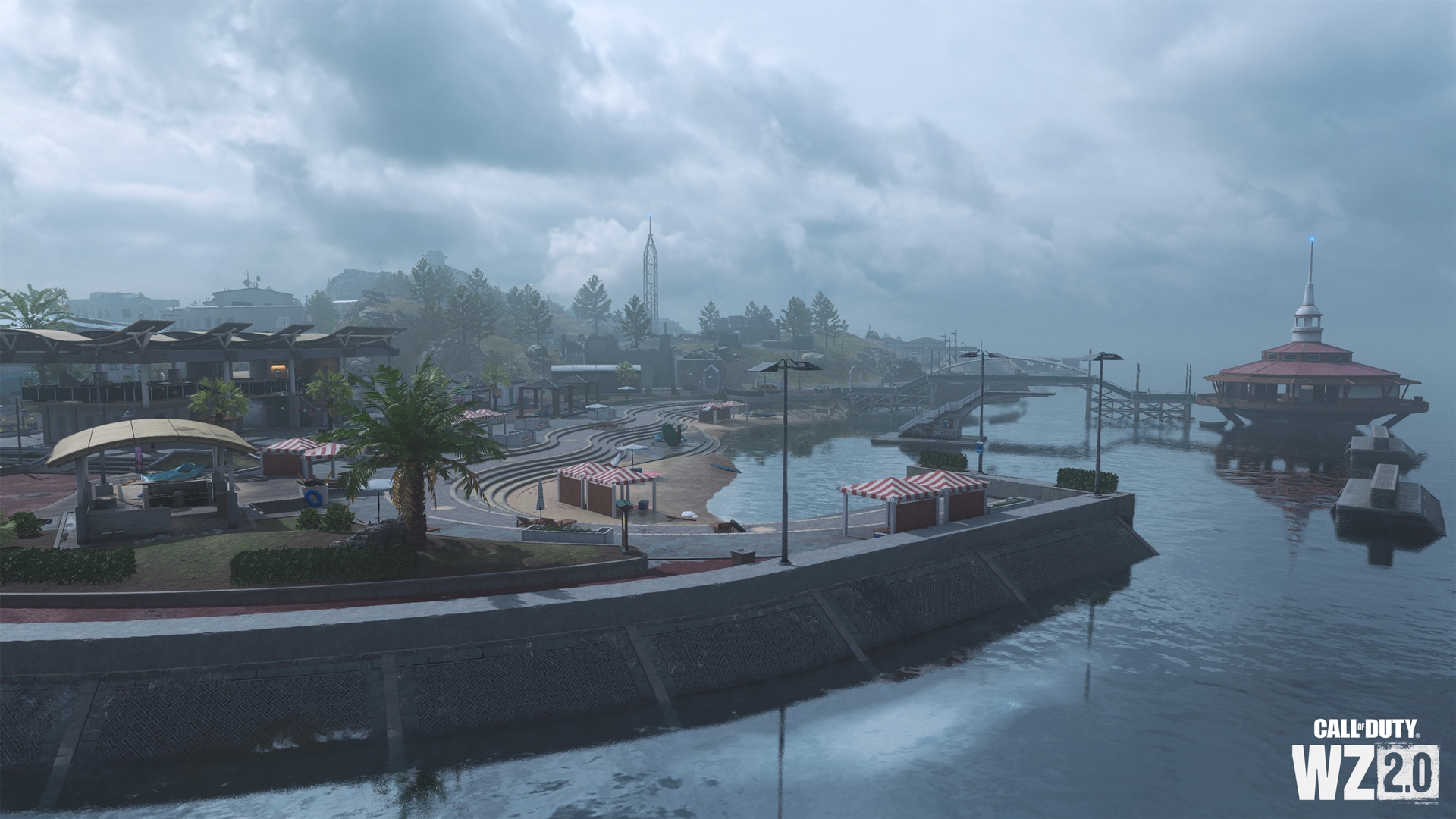
Southern Breakwater and Floating Refueling Station
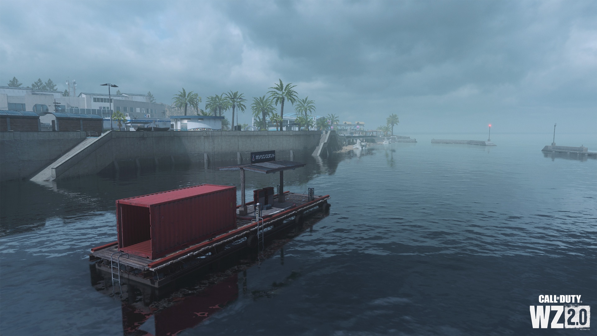
In harbors south of an open channel, the water is usually calm. There is a floating gas station where you can refuel and repair water vehicles, as well as go to the main part of the island by climbing concrete steps. On the breakwater, you can take an advantageous position with long-range weapons, but keep in mind that there is nowhere to hide. Through the tidal pool below the aquarium, you can make your way to the island below the main entrances.
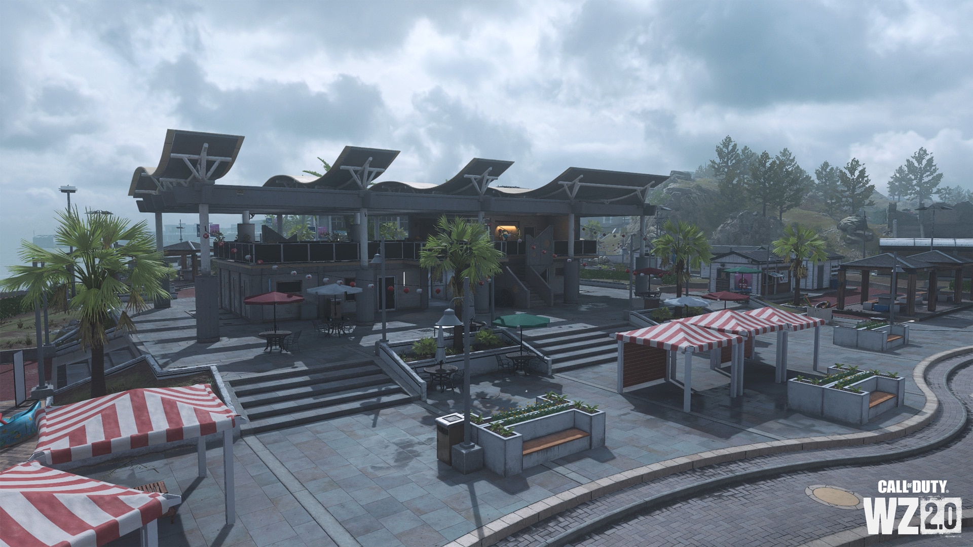
Market area and hotel
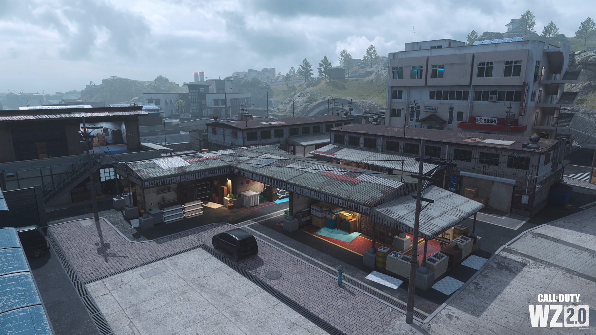
This is a small group of warehouses and stalls selling local products. Here you can fight on the rooftops and among the numerous shelters, as well as easily get to the water and the canal. East of the market, on the other side of the main street, is a hotel with a ground floor lobby, a sushi bar, lift access to the top floor, two luxury rooms and rooftop access.
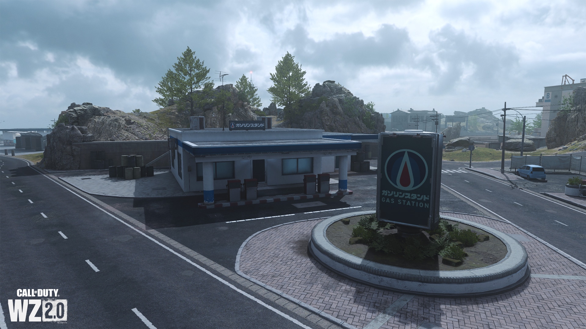
Gas station
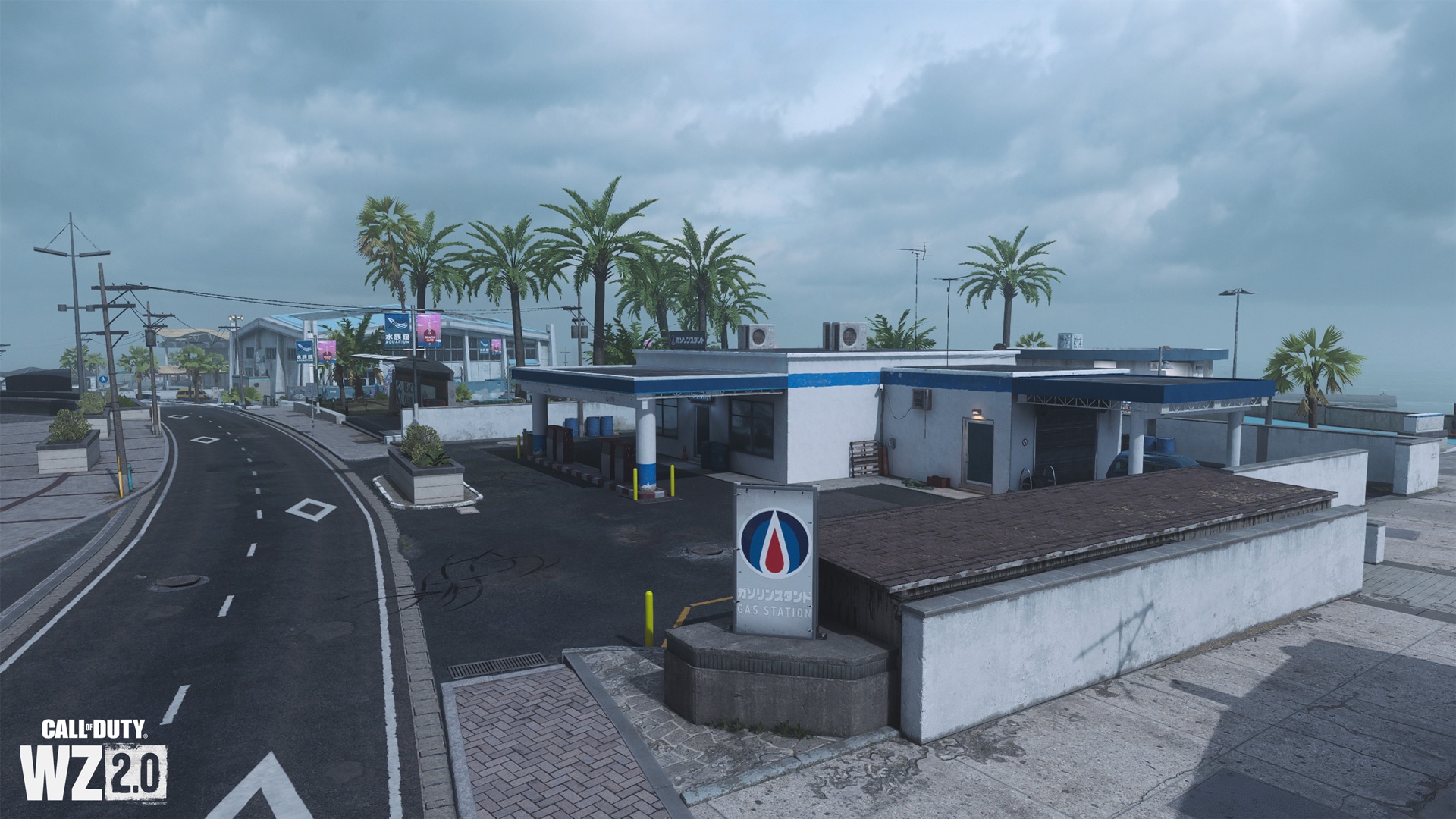
To the south of the market is a gas station where you can quickly refuel and fix vehicles, and a round toilet near the concrete boulevard. From here you can quickly get to the bay or to the nearby town hall.
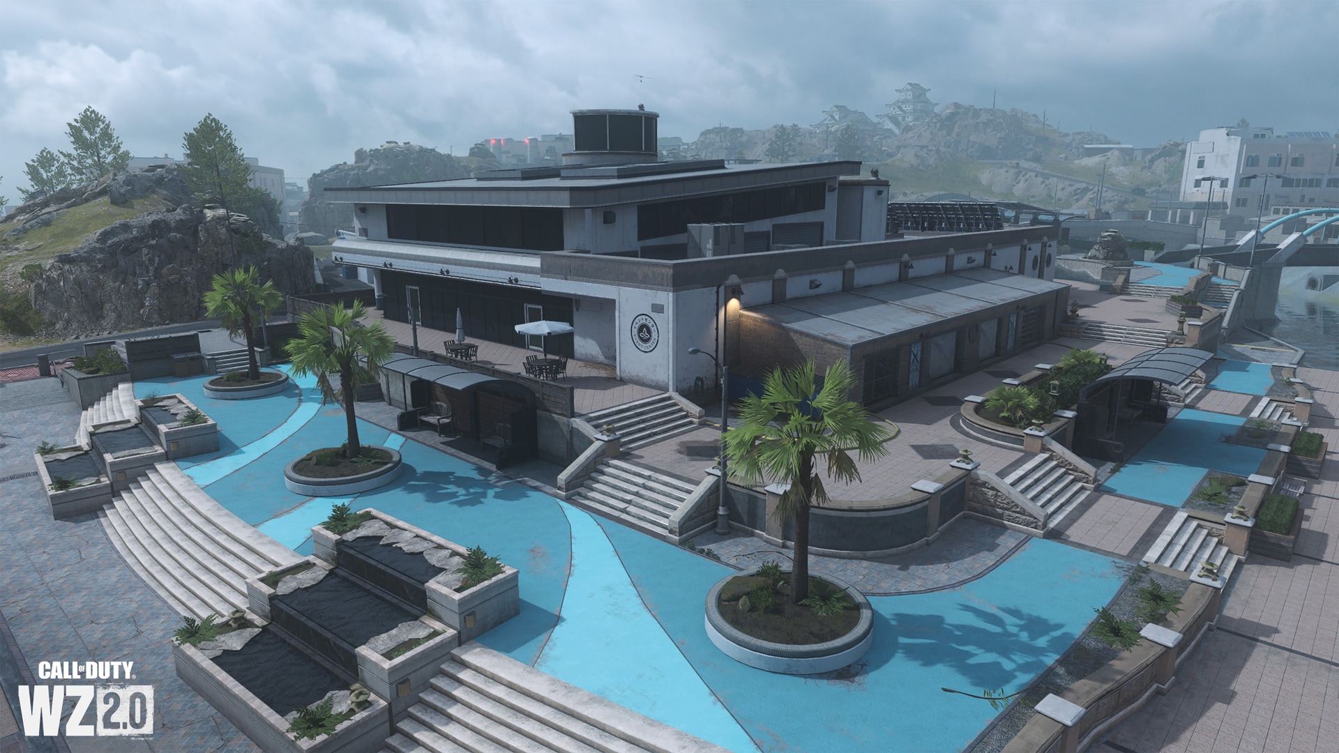
town hall
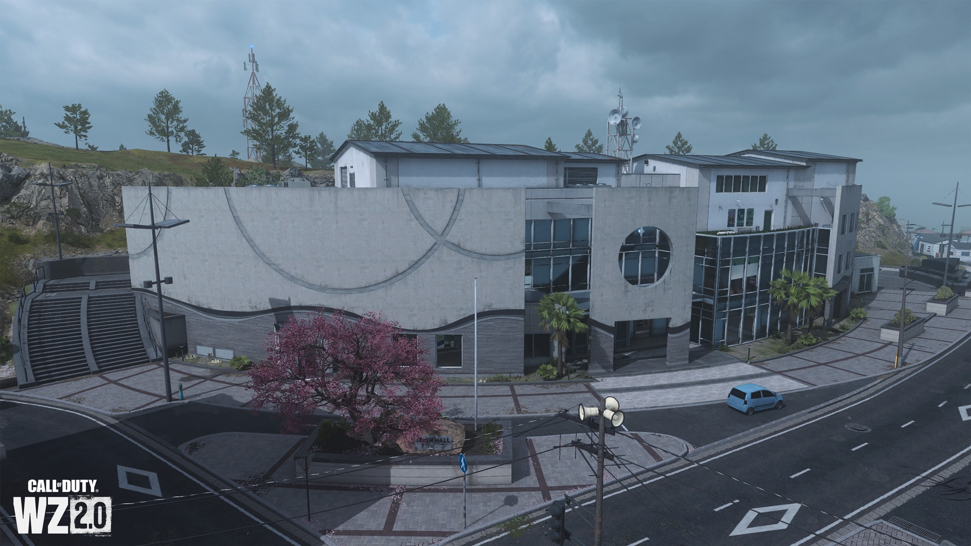
A beautiful modern building in the shape of a semicircle, which is a labyrinth of concrete and glass. Inside there is a spacious open-plan hall on the ground floor and escalators leading to the second floor with a small kitchen, an internal balcony where the display cases are located. Also on the second floor you can find a rock garden, partly located in the open air. Behind the building is a rocky area, allowing you to find cover or go to the castle grounds.
Attraction: beach club
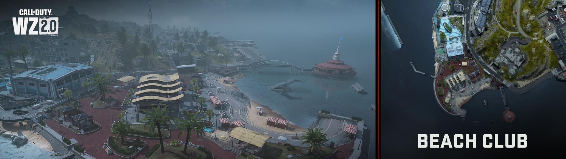
Southwest of the city center and east of the port are an aquarium, a beach club and an open beach on the island’s southwest coast. Parts of this area are highly visible during parachute landings due to the bright blue walkways.
Aquarium
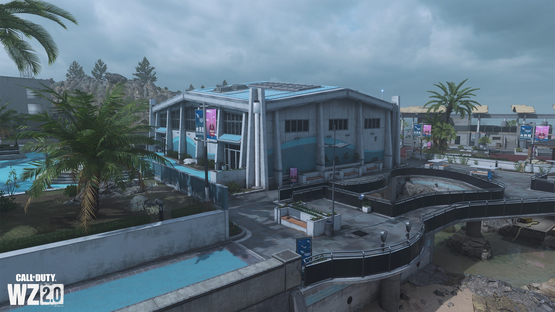
Most of the paths north of the aquarium are blue, making them easy to see from above. The lifeless-looking aquarium consists of a large exhibition hall, a small parking lot and an ocean-side tidal pool with a gray platform above it.
Beach club and sauna
These buildings can also be easily distinguished by the color of the paths – this time burgundy. There is a large open-air barbecue area, four small indoor houses and the main club building, some parts of which are also open-air. The main building also has two baths and a bar on the second floor.
Beach and observation deck
A small winding concrete staircase leads down to a compact beach, a bay surrounded by breakwaters with a diving board, a small parking area and a footbridge leading to a circular observation deck. I wonder what is hidden under the central spiral staircase?
demolition site
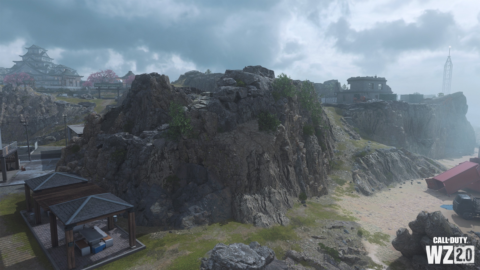
Spectacular views in the area of the beach club are only slightly overshadowed by the not completely demolished building on the cliff above the club. On the cliff you can find the ruins of a dilapidated building, from which only concrete and reinforcement remained. Please note that from here you can go to the town hall or climb to the castle.
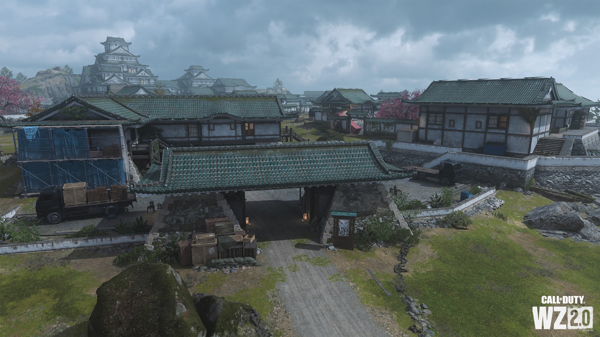
Landmark: Tsuki Castle
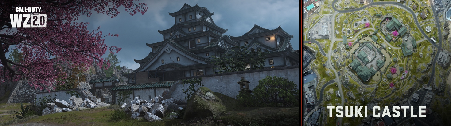
The hill in the central part of the Ashika Island map occupies an ancient castle with numerous fortifications, covered from the southwestern part by a hill. On this large plateau, you will see low, stepped battlements, flowering cherry trees, and additional buildings at various points throughout the castle grounds. Tactical opportunities await you at every turn – and don’t forget to watch your step, because under this fortress there is an underground channel and an entire submarine base!
Main citadel
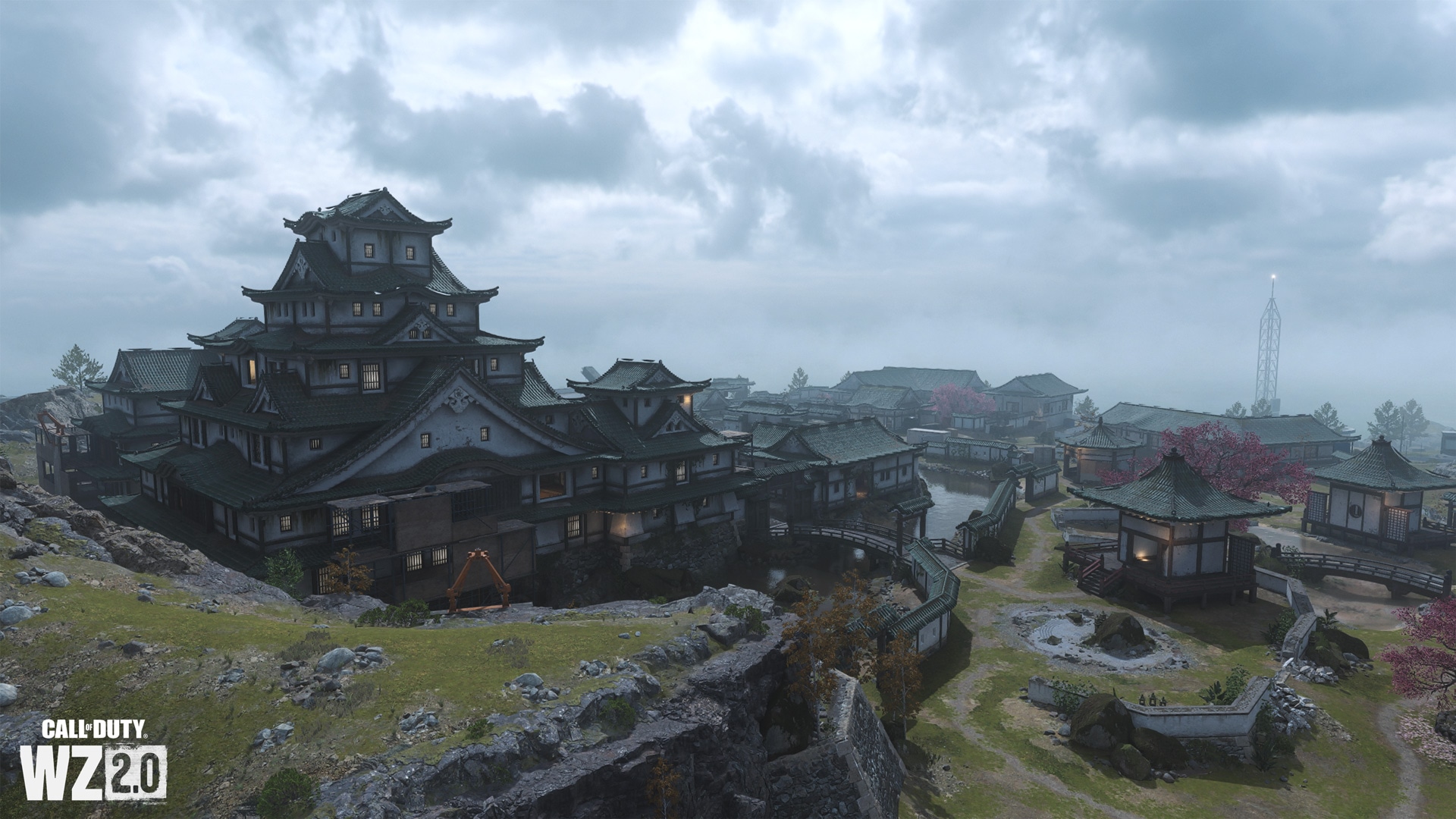
Recent fighting has damaged the ancient walls of this majestic castle, but here you will find plenty of hiding places, entrances and points of interest above and below ground. The inner defensive circle of the citadel begins with a moat that surrounds it on three sides (on the fourth side there are hills that do not allow closing the ring around the base). Behind the moat there is a wall with several passages into the courtyard, from which you can get to the fenced open “dojo” and the adjacent building, where the mobile radar is located.
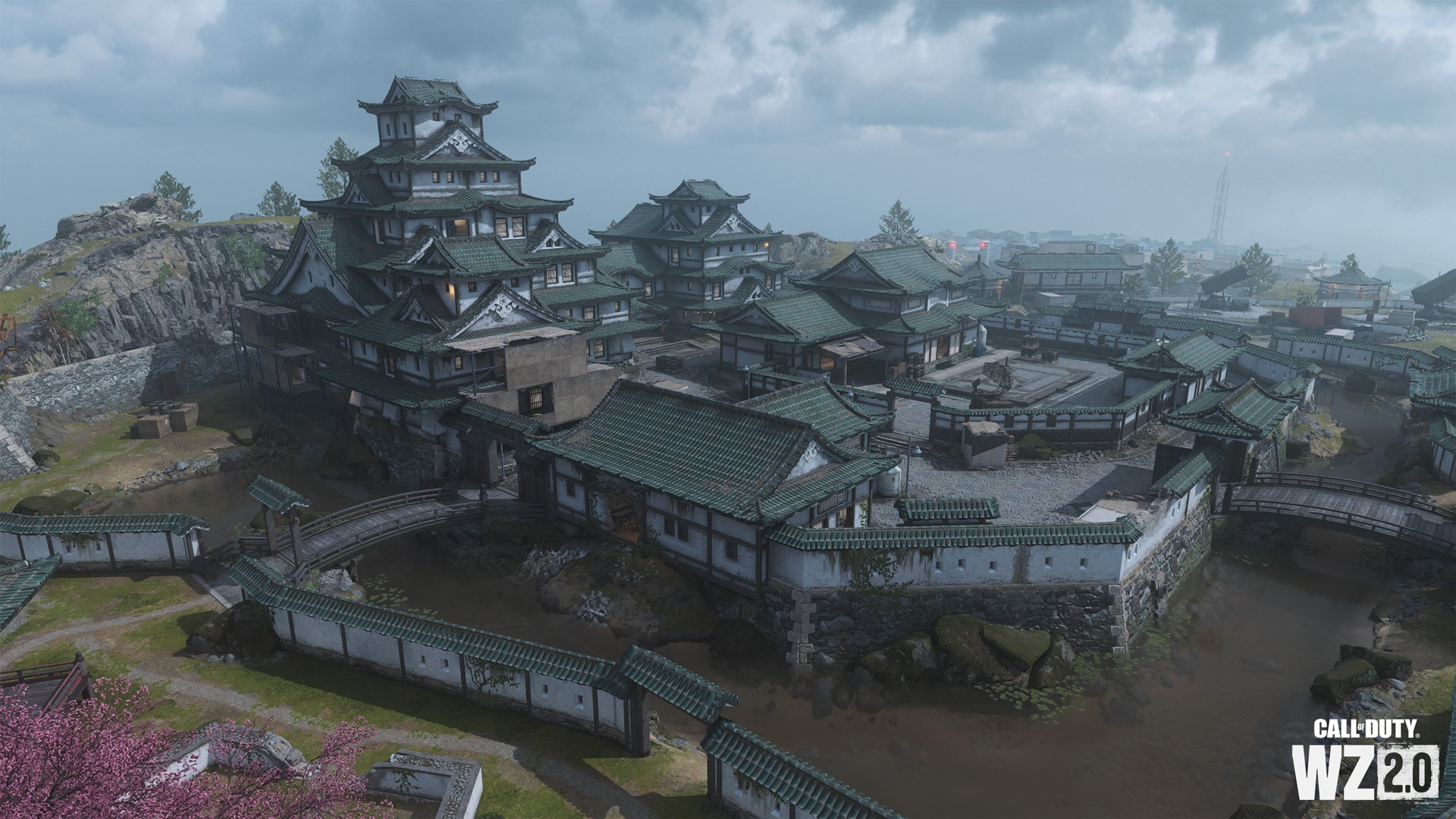
In the first courtyard there is also a small building, which recently served as a barracks, and the main fortress of the castle, towering above the rest of the buildings. This L-shaped building consists of a central and two small outer towers. You can get in or out on the tiled roofs. Inside this building are large rooms, wooden corridors, an internal balcony above the main room in the central tower, as well as a server room on the roof, from which there is a view and exits in all directions.
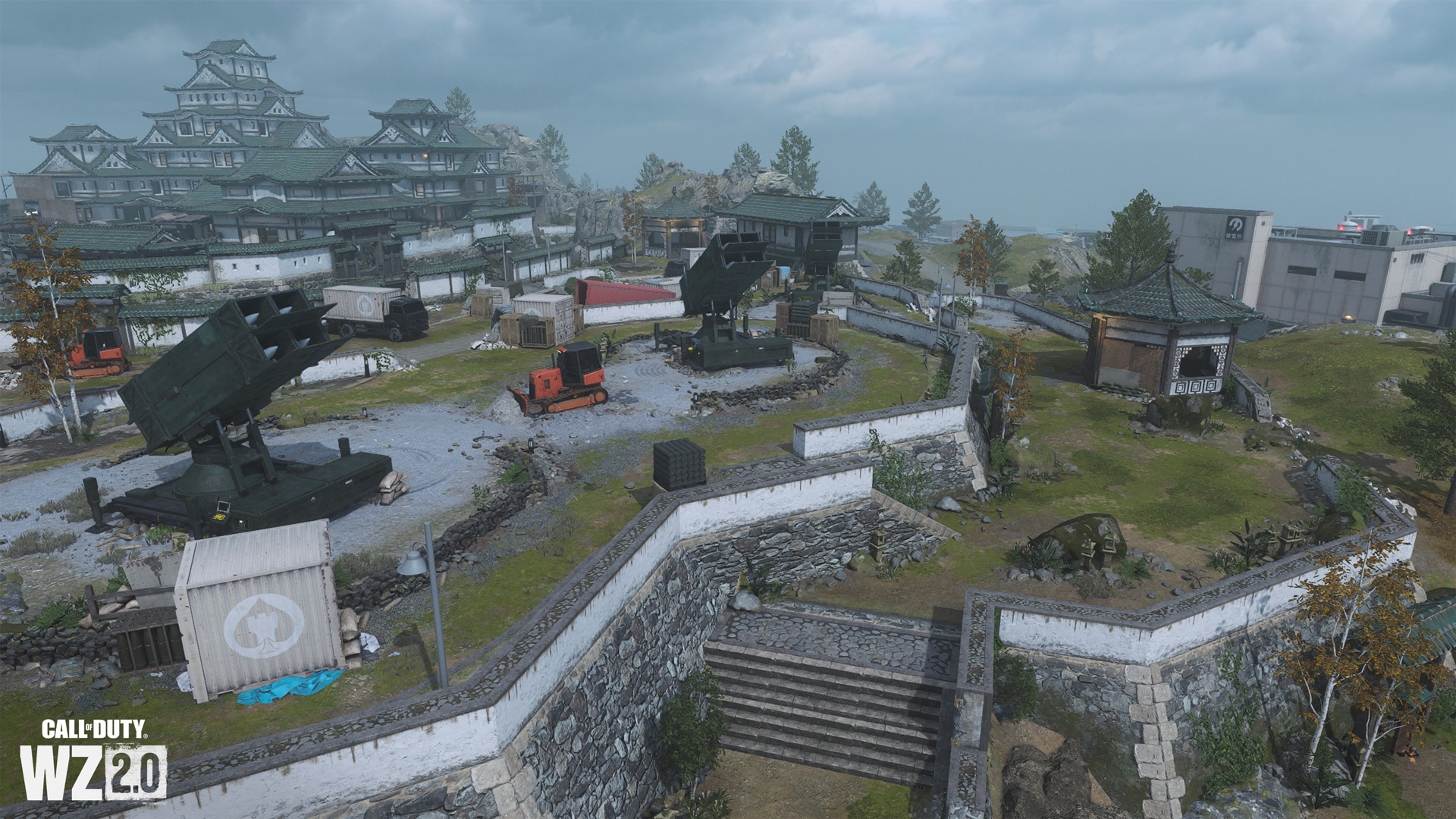
To the northwest of the castle, a stepped slope rises above the power plant and residential area, on which are three hastily installed SAMs, low walls already damaged in battle, various containers and earthmovers, and an old well. If you want, you can check what is at the bottom of it.
Museum grounds in the north
Old buildings on the northern border of the castle territory are combined into two groups. You’ll find a walled museum with a courtyard, a small ceremonial house, two two-storey buildings connected together, and several display cases dotted along the corridors (most of them broken). In addition, there is a server room on the top floor of the largest of the buildings. To the east is the northern (now main) entrance to the castle grounds and a visitor center with a raised floor under which vehicles can pass. From there you can quickly get to the moat surrounding the courtyards.
Gardens in the southeast
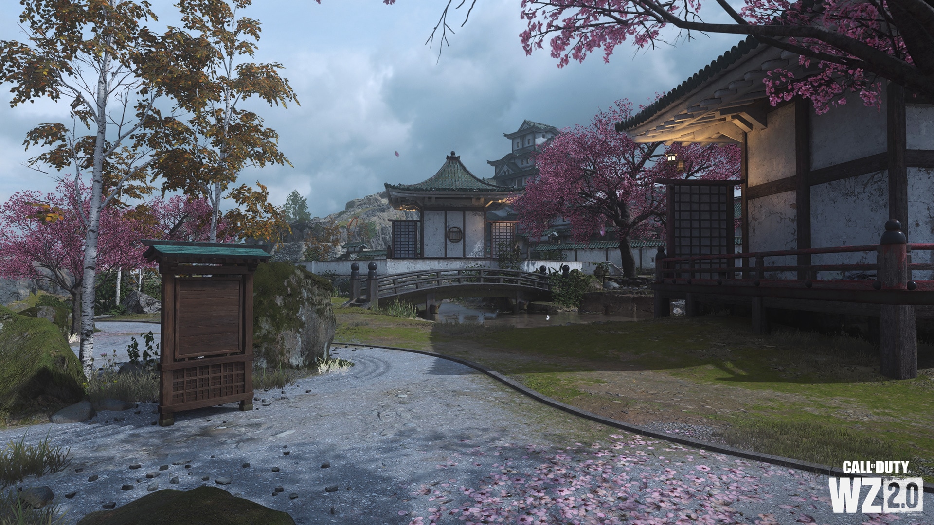
Before the outbreak of recent hostilities, serenity reigned in this corner of the castle territory. There are rock gardens, birch trees, benches, houses for ceremonies and bridges. Fight in these gardens or go through them to the area above Port Ashika.
Waterways (submarine base)
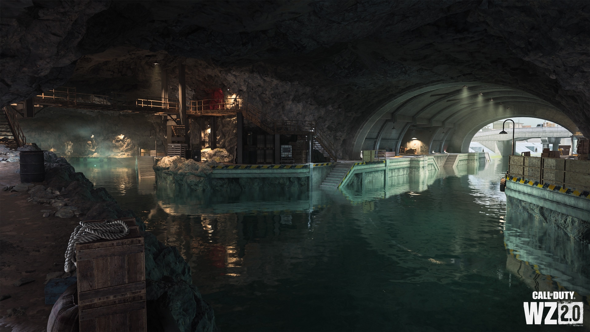
In the cave below the castle is an extensive system of tunnels, which the locals call “waterways”. They are underground passages between the western (city center), northern (water treatment facility) and eastern (Asika port) parts of the island. And don’t forget that there are numerous passages available for performers between this area and the castle grounds. You can navigate the interconnected canals by swimming or boating, and explore the central submarine dock to find many alcoves and secret passages.
Point of Interest: Asika Port
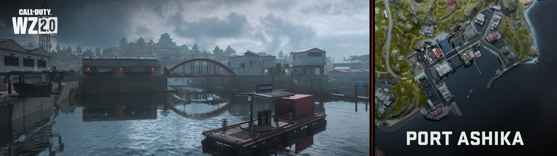
The southwestern edge of the map is occupied by rocky cliffs and a port named after the island. To the north is a slope leading to the castle, and towards the ocean are a variety of industrial warehouses, offices and a communications tower, as well as a canal leading to an underground submarine base.
curved bridge
Following the paved road leading around the perimeter of the island from the beach club to the port of Asika, you will come to a short arched bridge. Watch out – opponents can hide under it!
Port and warehouses
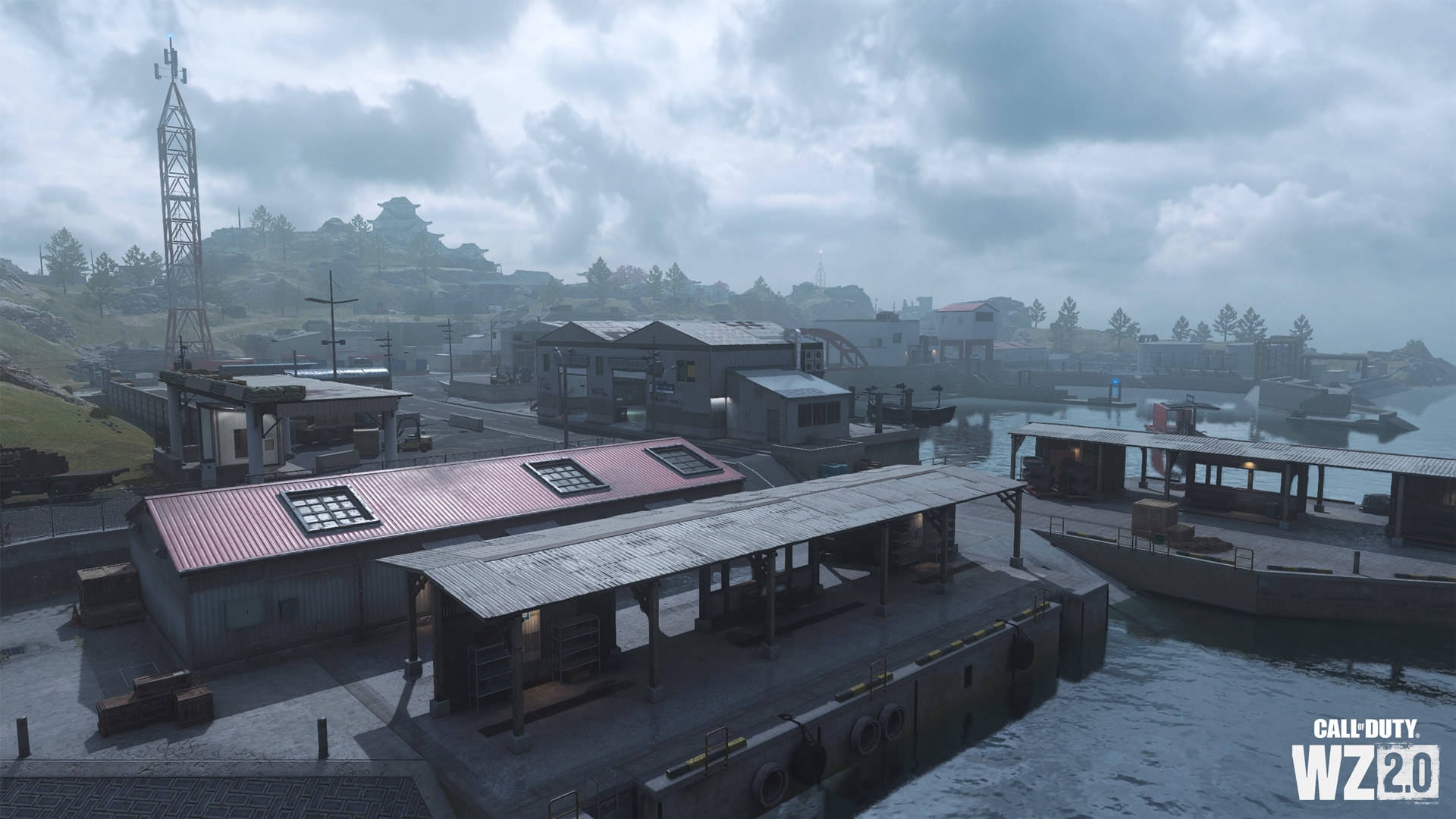
To the west of the bridges across the canal is an industrial area where warehouses are located. To get there, you need to overcome the entrance and covered barrier. Nearby there is a building with a red roof (repair and storage of ships), two open storage for boats, a launch for boats and a large warehouse with two open moorings. A small parking lot leads to a courtyard with containers and a communication tower (one of three on the island).
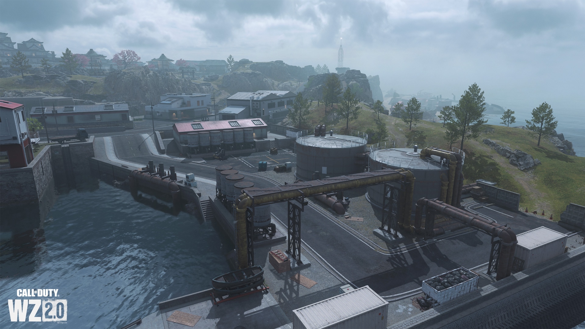
Channel: river bed and management
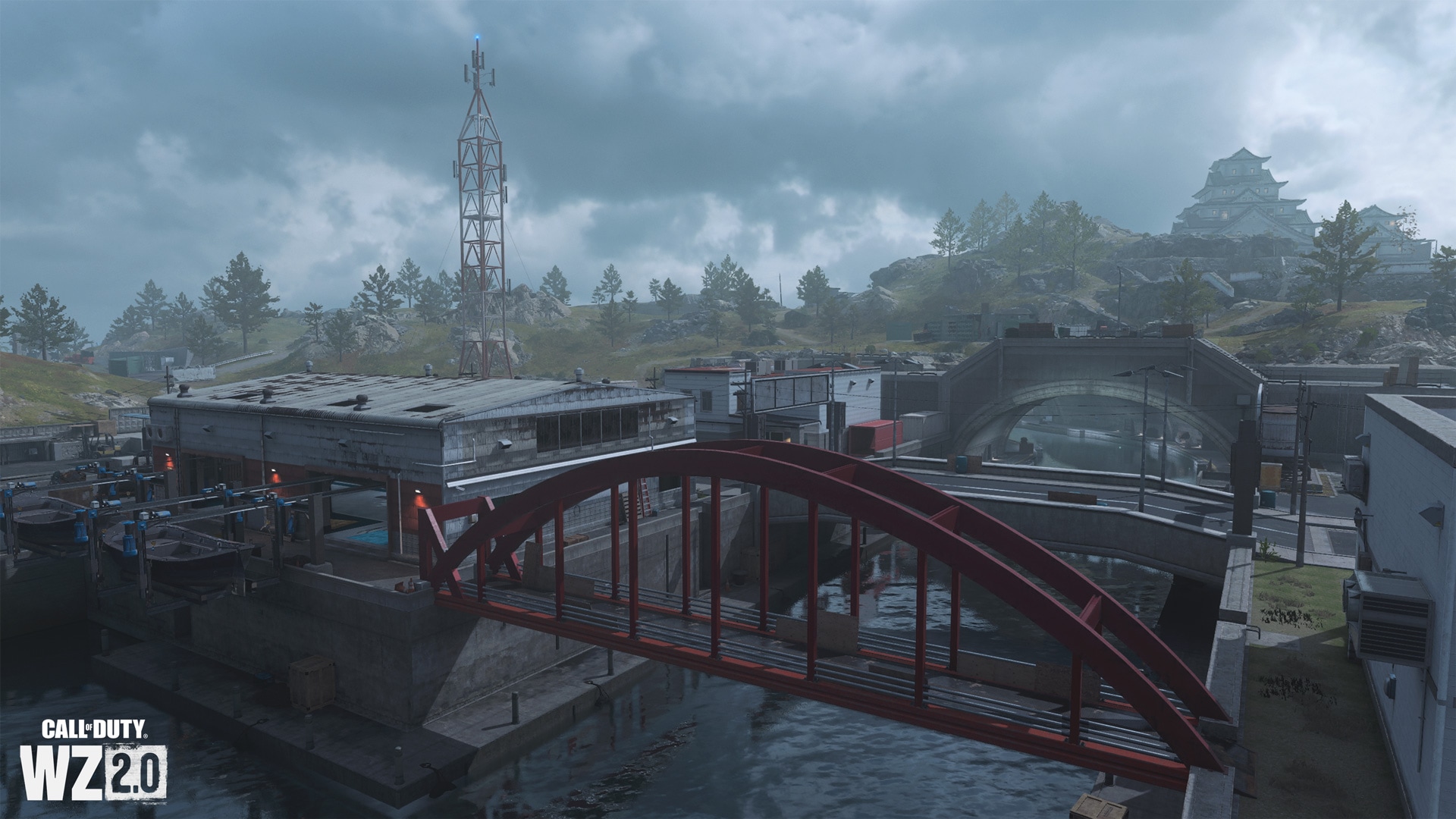
Next to the red footbridge on the other side of the canal is the harbormaster’s office and a large warehouse with two ship lifts. The channel divides the port into two parts and leads to a large underground submarine base under the castle. To the northeast of the red bridge is the management building, and server rooms and offices are located on the embankment.
Asika Bay and floating gas station
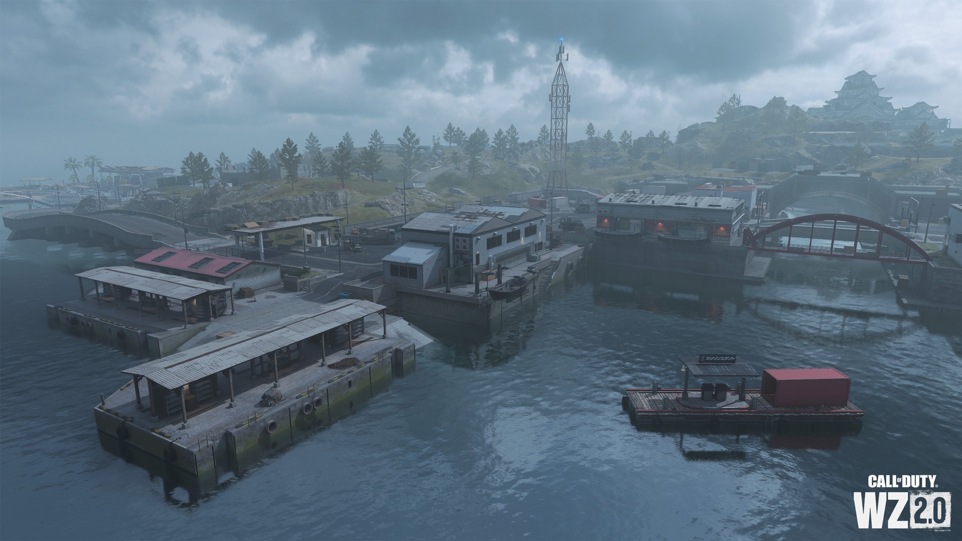
Thanks to the powerful breakwaters, the waters here are calm, and the harbor looks peaceful … until the performers start fighting. A filling station for water transport is installed on the pontoon. There are several berths in the bay where you can land on the island, and along the channel you can get to the submarine base with a breeze or leave it if you have water transport.
Gas station
On the opposite side of the canal from the administration building is a gas station, through which you can easily get to the main road (but only if you are not coming from the side of the castle).
Yard with workshops and oil tanks
There are four medium-sized warehouses located in the northeastern part of the port of Asika, mainly storing mechanical parts. Inside the building, on a high foundation, are boat parts, a two-story office, an open warehouse on the side of the road and a barrier, and outside, a low building with a red roof and oil tanks in an external parking lot. Next to the water are additional tanks ready to be filled and transported. Pay attention to the cliff overgrown with grass and the passages between the buildings and the rocky beach.
rocky cliffs
The area near the east exit is occupied by a small picnic area and high rocky cliffs, which offer a good view of the containers scattered on the coast to the northeast. It’s easy to get out of sight here, so watch out for an ambush (or arrange one yourself).
Attraction: residential area
In the lowland under the walls of the castle, to the northeast of the farms and allotments, there are residential buildings and two industrial buildings (a power plant and a water treatment plant). The area can be easily accessed from the paved roads surrounding it. Explore it on the ground and underground – many discoveries await you.
Residential complex
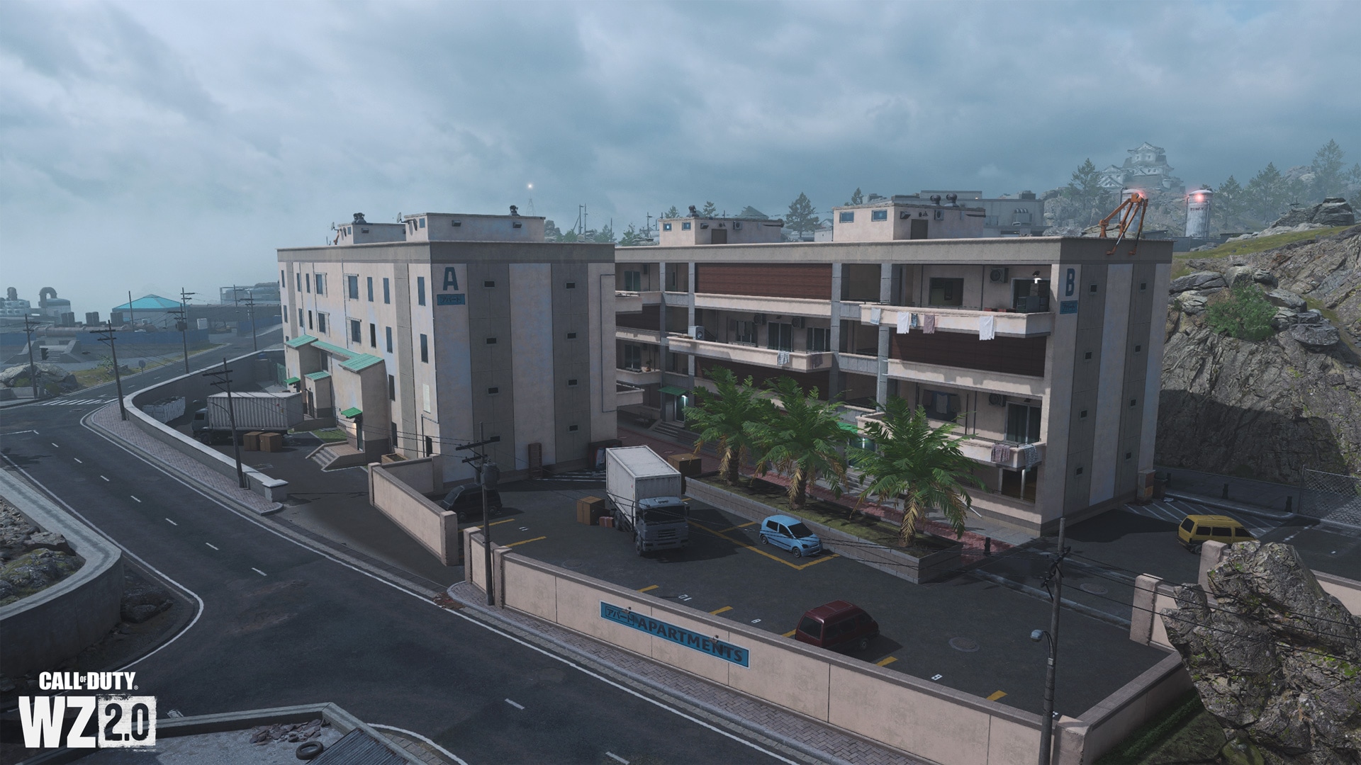
To the west of the main residences is a small residential complex surrounded by a low wall. You can get inside, on the stairs or on the roof of any of the two four-story buildings, marked with the letters A and B. The residential complex has a barbecue area, a swimming pool and a tennis court.
Power station
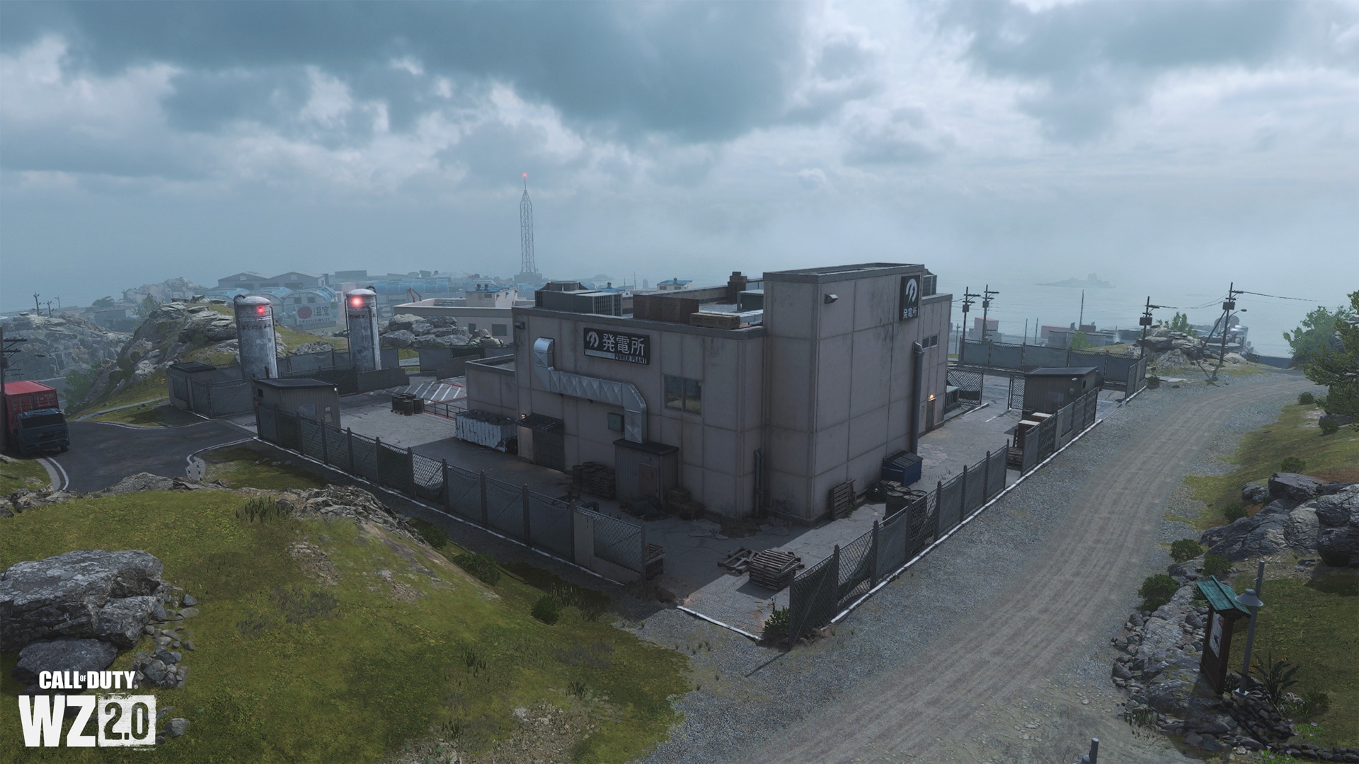
To the west of the castle, in a triangular courtyard surrounded by a mesh fence, there is a power plant that supplies electricity to the entire island. A large turbogenerator is installed inside. Based on map data, this building and the water treatment facility to the northeast are connected by a pedestrian tunnel.
Water treatment plant
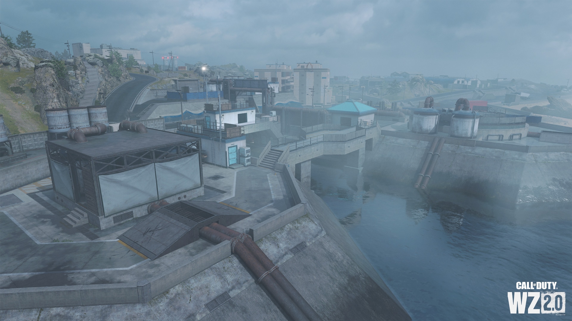
In the center of the northern coast of the island there is a small water treatment plant, as well as a third channel that allows access to underground waterways. On the surface there is a sewer tank, three containers and office houses, and after crossing the road you will see an upper pump, a small office and a tunnel entrance. Through this tunnel, you can secretly sneak into the power plant or go down to the waterways.
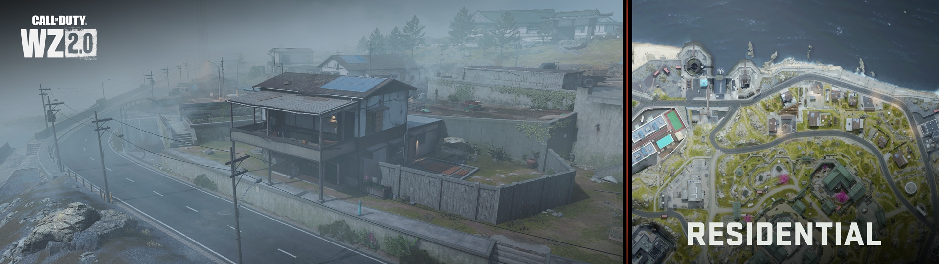
Residential area
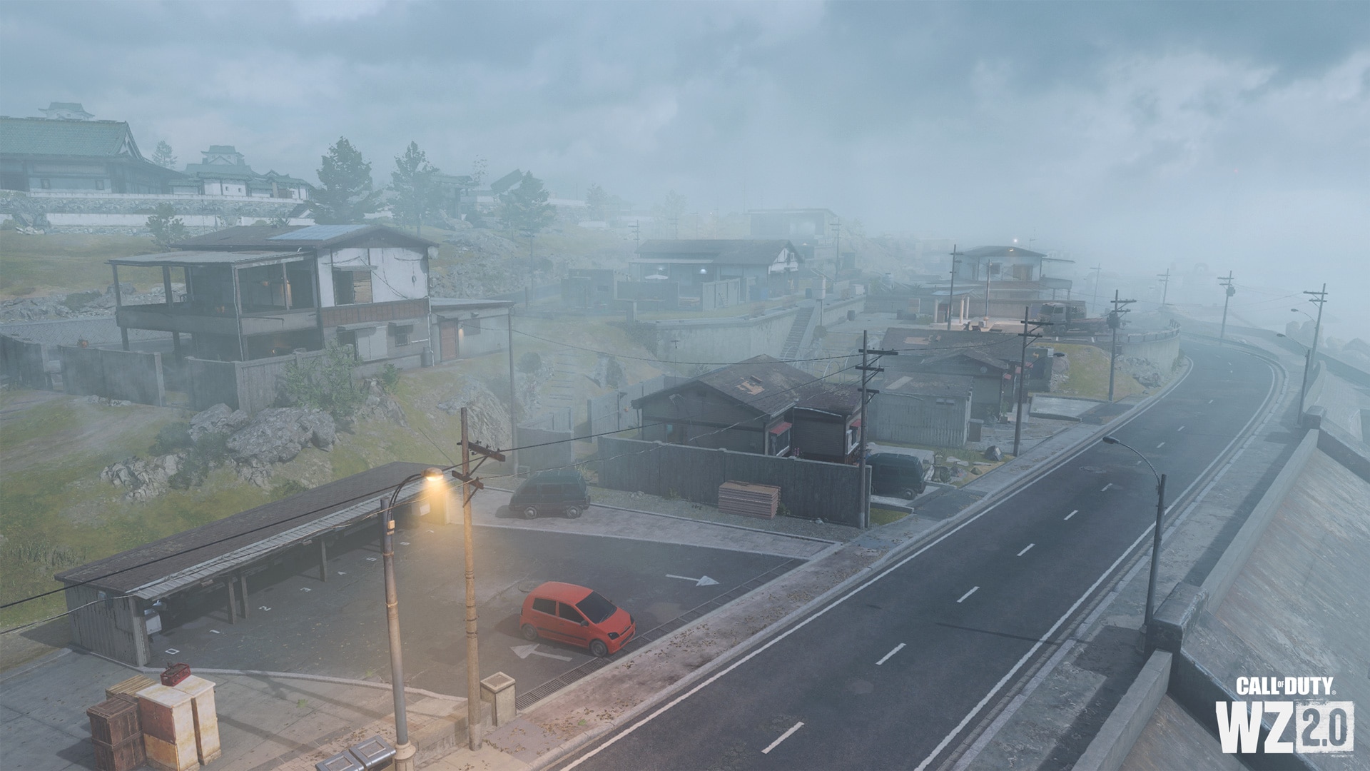
The residential quarter occupies a small area of rocky terrain to the north of the castle. It is flanked by a water treatment plant (to the west) and a communication tower with a gas station (to the east). The main roads are surrounded by nondescript wooden dwellings, each of which can be entered. Some buildings are two-story, others are one-story. To the southeast is a round latrine, a bus stop, and a road to the shipwreck and Ashika Port. This section of the Ashika Island map is shrouded in light fog, which impairs visibility at long distances and under certain conditions. Fog will not affect fast-paced close-range combat in any way, but it can interfere with snipers.
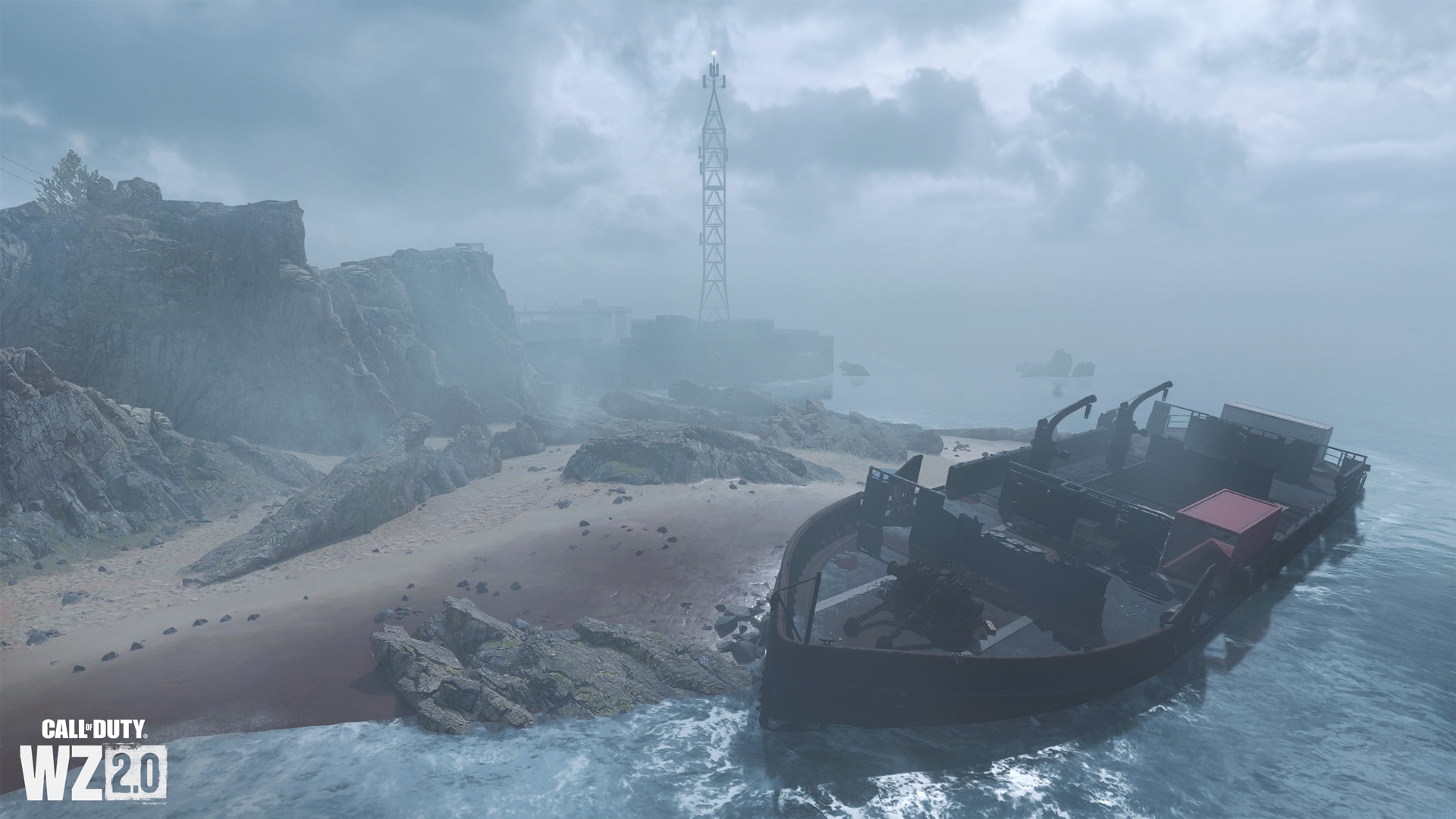
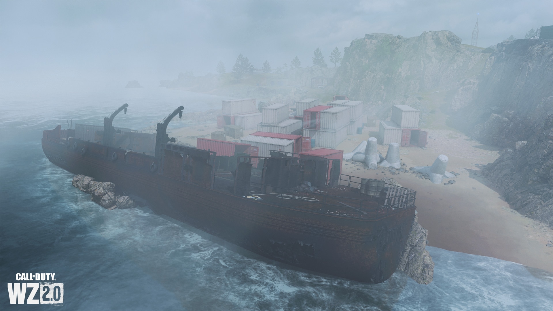
Attraction: shipwreck
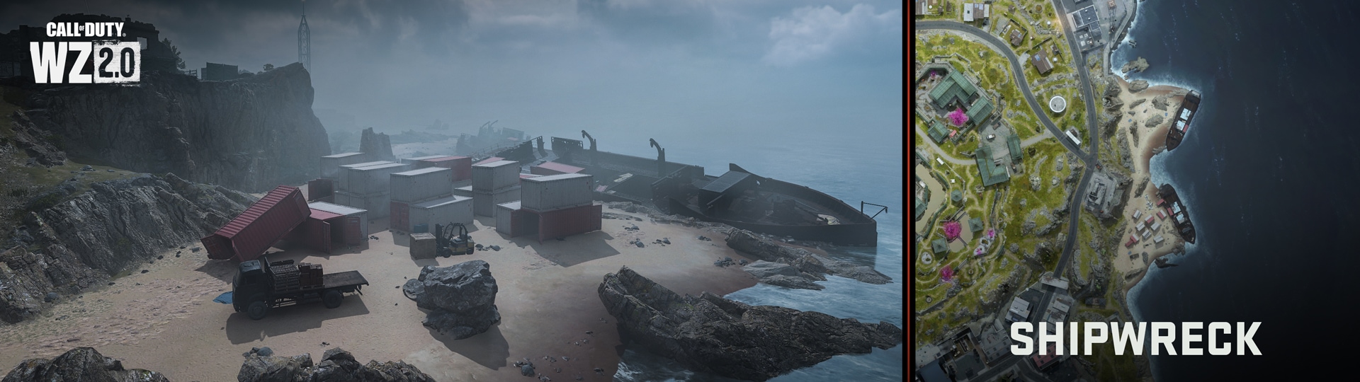
Two cargo tankers were wrecked due to inclement weather and dangerous navigational conditions near the coast. Both ships ran aground, but most of the containers they were carrying were evacuated and folded nicely. To the northeast are cliffs and the main paved road that runs around the perimeter of the island, as well as a communications tower, an observation deck, and a gas station.
Cargo tanker aground
Descending from the cliffs to the windswept beach, you will see one of two identical rusted cargo tankers that have been wrecked on this shore. The ship tilted heavily towards the ocean, but its hull survived.
Cargo tanker aground
On this part of the coast there is a heavily damaged and rusted wreck of a cargo ship. Most of the containers loaded onto it were evacuated. Note the hole in the superstructure.
Containers
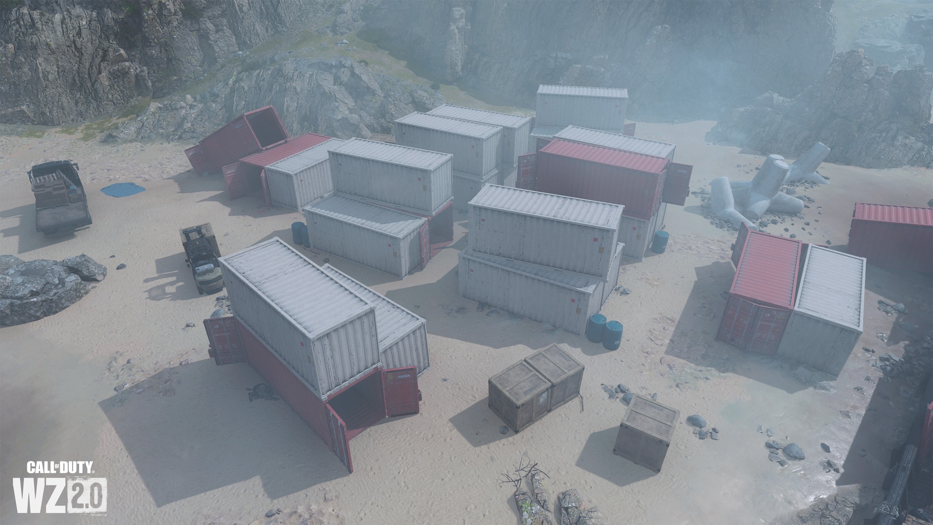
At the foot of the cliffs are empty cargo containers from wrecked tankers. Local loaders beautifully laid out the containers in a way we already know …
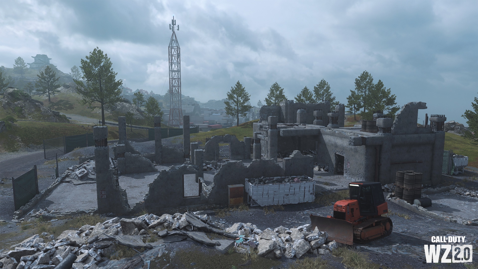
Demolition site on the cliff
On the cliff stands a partially demolished old concrete building. The height of these ruins and the view from them may interest you – occupy a high place or prepare an ambush for enemies on the main road.
Observation deck and gas station
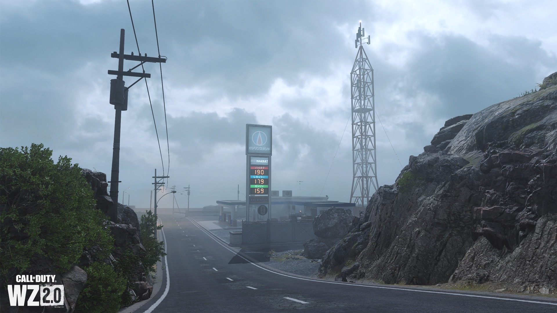
On the northeastern edge of the island is a communication tower (one of three on the island) and a platform that offers a great view of the castle, but there are no shelters on it. Below are breakwaters and a rocky shore, as well as a small gas station next to a residential area and the main road.
The Ashika Island map is available in the Battle Royale Respawn mode.